


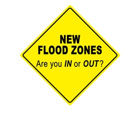
New FEMA Flood Insurance Maps to be enacted in November; City Works to Educate Property Owners
Because of Efforts of Syracuse City Officials, Residents Will Qualify for a 15% Discount on Flood Insurance Affected Residents Will Receive Post Cards with Information about Flood Insurance Programs Community Invited to Give Input at Common Council Committee Meeting on August 9 at 5:30 p.m. SYRACUSE, N.Y. – The City of Syracuse Department of Engineering has sent post cards to local residents who will be affected by changes in the new Federal Emergency Management Administration (FEMA) floodplain maps. These now-finalized maps come after nearly a decade of City officials pressing FEMA to produce more accurate maps, removing parcels needlessly included in the floodplain. The City of Syracuse participates in the National Flood Insurance Program which lowers rates for customers by subsidizing flood insurance for businesses and customers. To be eligible to participate in this program, the City must adopt the new federal Flood Insurance Rate Maps. In the original floodplain map, there were 963 parcels included. Of those, 237 were removed as a result of the City’s effort. A further 876 parcels were added as a result of the new federal mapping. Property owners seeking flood insurance will benefit from the City’s floodplain management strategies, which allowed a rating giving the City a discount. The Syracuse Common Council will hold a public meeting to gather input on these maps on August 9 at 5:30 p.m. At that time, affected residents will be able to ask questions of City engineers and officials from the New York State Department of Environmental Conservation (NYSDEC) in advance of the body ratifying the new maps. Property owners now added to the floodplain map who believe they were added in error will be asked to complete a letter of map amendment, including a survey from a licensed surveyor, and submit it to FEMA, which will make a final determination. The property owner will then be required to provide FEMA’s determination to their mortgage holder. For more information, residents can visit a new City webpage, www.syrgov.net/flood, with information about insurance programs and federal research. Click here 2016 SFHA 100 year Flood Zone for updated Flood Zone Map Affected areas in Syracuse Harbor Brook Meadowbrook Onondaga Creek Onondaga Lake Ley Creek Brief History of new flood maps • New Flood Insurance Study in Syracuse started by Federal Emergency Management Agency ( FEMA) in 2005. • Draft Flood Insurance Rate Maps provided to Syracuse in 2008, 2010, and 2012. • City of Syracuse reviewed the draft Flood Insurance Study and Flood Insurance Rate Map and found errors. • FEMA corrected mapping based on City appeals; Senators Schumer and Gillibrand helped City appeals. • City review and appeals helped to reduce the number of parcels in the newly-mapped Onondaga Creek floodplain by over 30%. • Final Preliminary Flood Insurance Rate Maps provided by FEMA in May 2015; FEMA Final Letter of Determination in May 2016. • Syracuse is required to adopt the Flood Insurance Study and Flood Insurance Rate maps by September 2016 for them to be effective in November.